
| MAPS of CLARK COUNTY; to help in your research |
These maps are big in size, they will take a bit of time to read them but they are worth the wait. The bigger the file the more detail. If the maps got any smaller than they currently are, you would not be able to read them.
| Clark County Map |
| E. Moorefield Twp. |
| W. Moorefield Twp. |
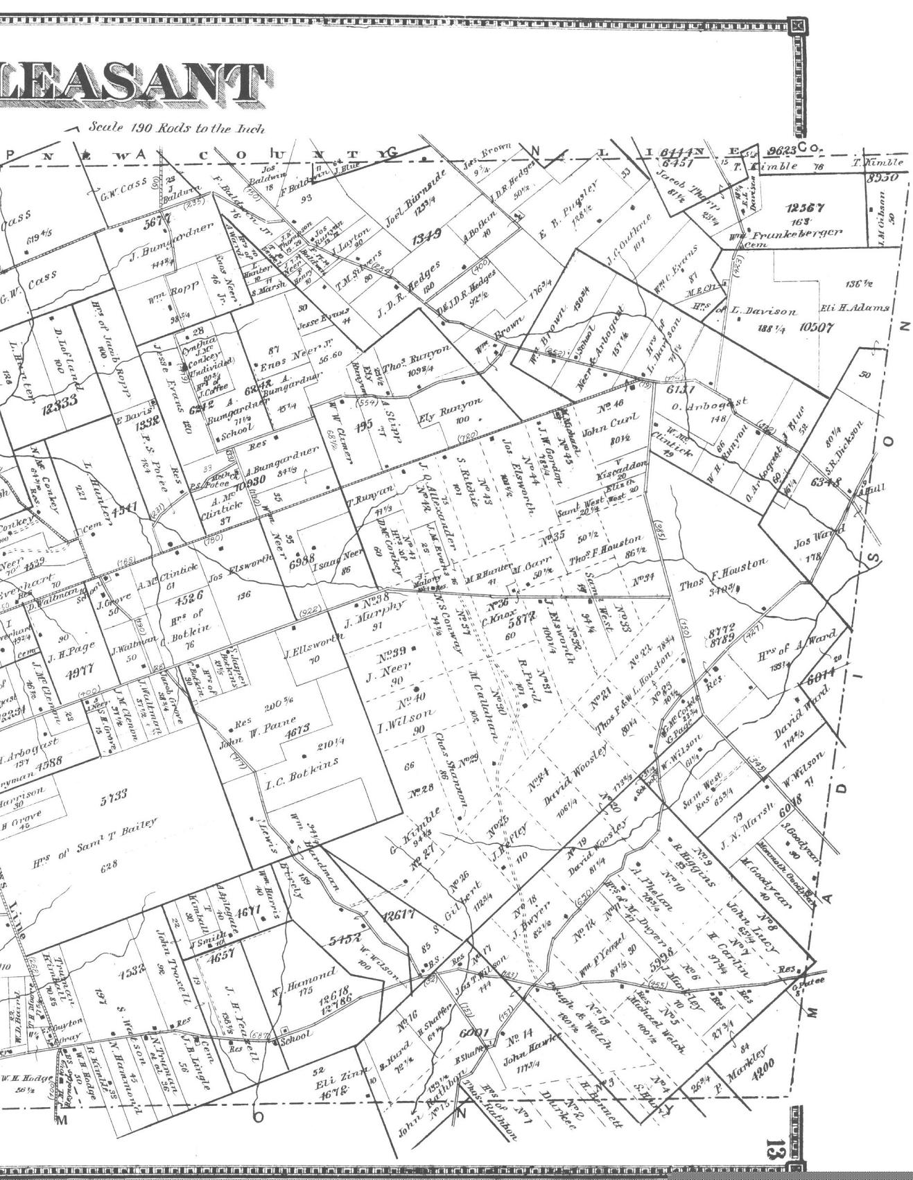
| E. Pleasant Twp. |
| W. Pleasant Twp. |
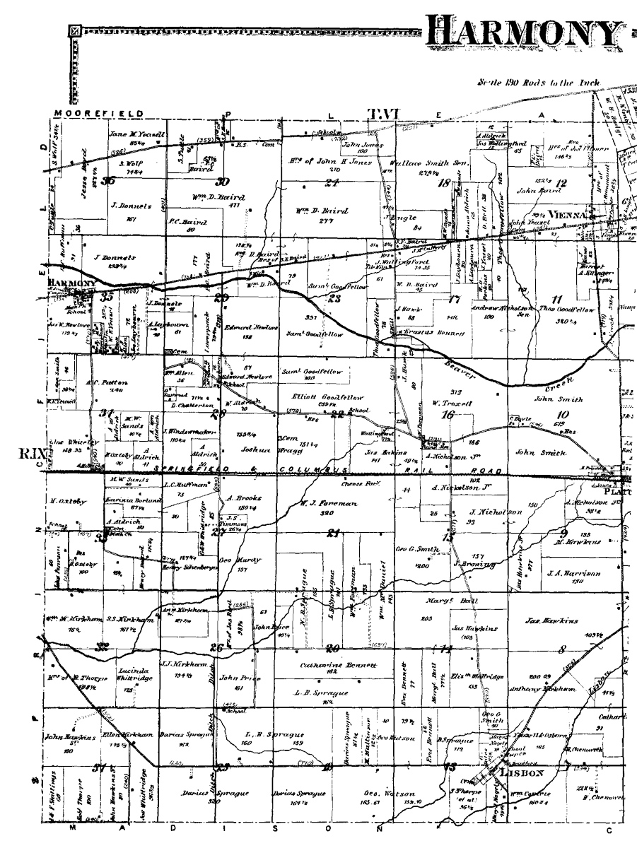
| E. Harmony Twp. |
| W. Harmony Twp. |
| Green Twp. |
| Mad River Twp. |
| German Twp |
| Bethel Twp. |
| Pike Twp. |
| Springfield Twp. |
Key
to reading these Maps.
Most of Clark County lies in
the
Between the Miami Rivers Survey (MRS). The northeastern and
southeastern
parts lie in the Virginia Military Survey. For the northeastern part,
that
is everything east of the Ludlow line, and for the southeastern part it
is
everything south of the Little Miami River. In the Miami Rivers Survey
the
townships and ranges are reversed from the normal rectangular survey in
the
rest of the state, and in the United States as established by the
survey
of the first Seven Ranges in eastern Ohio. The Miami Rivers Survey was
done
as a continuation of the Symmes Survey (near Cincinnati and Hamilton
County,
Ohio) begun about 1787 or 1788.
In the 1870 atlas, the township and range numbers are shown in Roman
numerals
at the edges of the map. The section numbers are shown in the center of
the
section in Arabic numerals. Arabic numerals in the Virginia Military
Survey
area are the original survey (and usually patent) numbers. In both
surveys
roads are double lines; single lines represent township, range, and/or
property
lines in the MRS; dotted lines and thin solid lines represent property
lines
in the VMS with the survey line being the heavier solid line. The
acreage
of each property is also shown if there was enough room for it. A small
dot
indicates the location of a residence.
Original Ohio Land Subdivisions, Vol. III, page 71 of the Final Report by C. E. Sherman, C. E. published by the State of Ohio Department of Natural Resources. Printed in 1925, Reprinted in 1991. For more information you can visit their web site at Ohio Geological Survey. Some information about this map - The surveyed township, range and section always remained the legal description regardless of what county the land lay in at the time the deed was drawn. So although the deed may show the land was in Hamilton Co. in 1799, looking at this map shows you the land now lies in Greene Co. or Clark Co. This has been very useful any researcher in running down records of land purchased before Clark Co. was formed.
CRAZY FOR MAPS:
| updated 7/25/2014 |
copyrighted
1997-2014
this site may be freely linked to, but not duplicated without
consent